






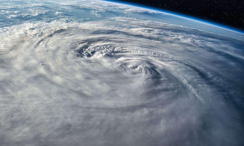

As hurricane season winds down, it’s a good time to look back at the storms that have shaped Edisto Beach and the surrounding Lowcountry. From a direct hit in 1959 to the tropical storms that buried Palmetto Boulevard in sand, each one changed the coastline, the community and the way the island prepares. (The Atlantic hurricane season officially runs through November 30.)
Hurricane Gracie (1959)
Gracie is the closest thing Edisto has had to a direct hit in modern times. On September 29, 1959, it came ashore over St. Helena Sound, at the south end of Edisto Island, as a Category 4 hurricane with 130 mph winds. Its wind and surge caused widespread damage across the barrier islands and left a lasting mark on the community.
Gracie also reshaped the beach itself. In the rebuilding that followed, marsh sediment was dug up and moved to the shoreline. That’s a big reason so much of Edisto Beach today is made of shell hash, and it opened up new oceanfront lots that fueled development along the beach.
Hurricane Hugo (1989)
Hugo came ashore at Sullivan’s Island, more than 40 miles up the coast, as a Category 4 storm and set the all-time record tide in Charleston Harbor at 12.5 feet. Edisto sat on the storm’s weaker southern side, so it was spared the catastrophic damage seen from Charleston northward, but the island still had strong winds and some flooding. Hugo remains the benchmark storm for the entire South Carolina coast.
Close Calls and Floods (1996–2015)
For years Edisto seemed to dodge the big ones, with storms veering north or south at the last minute. Even near misses left their mark:
- Hurricane Bertha (July 1996) stayed offshore before coming ashore in North Carolina, but it came close enough to send vacationers on the front beach packing.
- Hurricane Irene (August 2011) passed more than 250 miles offshore. Its winds knocked the power out on and off, and at the evening high tide its surge pooled around the pilings of front-row homes and spilled onto Palmetto Boulevard and the side streets.
- Hurricane Sandy (October 2012) brought a tropical storm watch, gusty winds, big surf and dangerous rip currents as it passed well offshore.
- Tropical Storm Andrea (June 2013), the first named storm of that season, brought heavy rain and gusty winds.
- Hurricane Arthur (July 2014) put the coast on watch going into the Fourth of July weekend before passing offshore on its way to North Carolina.
- The October 2015 flood wasn’t a hurricane at all. Around 10 inches of rain fell in a short time on top of high tides and swell from Hurricane Joaquin, far offshore. Low-lying roads on the beach and the island flooded, the seawall was breached on October 3, and the Town declared a state of emergency.
Hurricane Matthew (2016)
Matthew made landfall near McClellanville on October 8, 2016, as a Category 1 storm, far to the north. Even so, it brought some of the worst damage Edisto Beach had seen in decades. Surge and waves damaged beachfront homes, cut into the dunes and covered Palmetto Boulevard in sand, and the National Guard helped clear the road. In Charleston Harbor, the tide reached 9.29 feet, at the time the third-highest on record.
The recovery took months. Up to four feet of sand covered parts of Palmetto Boulevard, the beach’s main water line broke, power was out for days and a boil-water advisory followed. Only residents with proof of ownership were let back in at first. Homes on the 100 to 700 blocks of Palmetto Boulevard were hit hardest, and some stayed uninhabitable well into 2017. The Pavilion closed for repairs, the storm stripped away most of the sea oats, sand fencing and beach access signs, and the beach at Botany Bay didn’t reopen until July 2017.
Tropical Storm Irma (2017)
Irma was only a tropical storm by the time it reached South Carolina in September 2017, but its surge topped Matthew’s, cresting at 9.9 feet in Charleston Harbor. On Edisto, it pushed about 12,000 cubic yards of sand onto Palmetto Boulevard, up to 4 feet deep in places, and heavily eroded recently restored dunes. State highway crews needed five days to clear the road. Irma proved that a tropical storm, not just a major hurricane, can do serious damage to a barrier island.
The governor ordered a mandatory evacuation of Edisto Beach starting September 9, 2017, one of eight South Carolina islands cleared ahead of Irma. When the town reopened days later, a boil-water advisory was in effect and the first 11 blocks of Palmetto Boulevard were still impassable. Botany Bay, which had just reopened after Matthew, closed again for the rest of the year and lost one of its most photographed trees, and Edisto Beach State Park’s oceanfront and Live Oak campgrounds closed through the end of 2017.
Tropical Storm Idalia (2023)
Idalia had weakened to a tropical storm by the time it crossed into South Carolina on August 30, 2023, but it arrived on a blue-moon king tide. Charleston Harbor crested at 9.23 feet, the fifth-highest tide on record. On Edisto, waves broke through the dune line, sand washed onto roads and, according to the town’s mayor, a 9-foot surge knocked down parts of the protected dunes. It’s a good example of how king tides can make a weaker storm far more damaging.
Charleston’s Highest Tides on Record
The Charleston Harbor tide gauge is the long-term benchmark for the Lowcountry coast, and four of its five highest readings came from the storms above.
| Storm | Year | Peak tide |
|---|---|---|
| Hurricane Hugo | 1989 | 12.5 ft |
| Unnamed hurricane | 1940 | 10.2 ft |
| Tropical Storm Irma | 2017 | 9.9 ft |
| Hurricane Matthew | 2016 | 9.29 ft |
| Tropical Storm Idalia | 2023 | 9.23 ft |
Why These Storms Still Matter
Edisto’s history shows that storms of every strength can reshape the island. Flooding, dune loss, beach erosion and property damage have come from weaker systems as often as from major hurricanes. That’s why the town has invested in groins and beach renourishment, including a 50-year renourishment agreement with the U.S. Army Corps of Engineers signed in 2023. With ongoing coastal change, sea-level rise and more development, understanding this storm history is essential for planning and preparedness.
Visiting During Hurricane Season
The Atlantic hurricane season runs from June 1 to November 30 and peaks around September 10. Most trips are never touched by a storm, and there is plenty of warning when one is coming, but it pays to plan ahead:
- Know the way out. Highway 174 is the only road on and off Edisto, so leave early if an evacuation is ordered and keep your gas tank full. Check your evacuation zone and route with the South Carolina Emergency Management Division, and follow the Town of Edisto Beach for evacuation and re-entry updates.
- Read your rental’s storm policy. Many vacation rentals don’t refund nights lost to a storm, even a mandatory evacuation. Ask before you book, and consider travel insurance bought before a storm is named.
- Pack a small kit. Bring water, easy food, medications, important documents, phone chargers and batteries. Power outages are common on the island during storms.
- Plan for pets. Many shelters don’t accept pets, so know where you’d go with them.
- Stay out of the water when storms are offshore. Even a distant storm can churn up big surf and rip currents on a sunny day.
- Never drive through flooded roads, and watch the Edisto Beach forecast and the tide chart, especially when a storm lines up with a king tide.


